What is the Line of Actual Control (LAC)? - International Relations | UPSC Learning
Topics
0 topics • 0 completed
🔍
No topics match your search
What is the Line of Actual Control (LAC)?
Medium⏱️ 7 min read
international relations
📖 Introduction
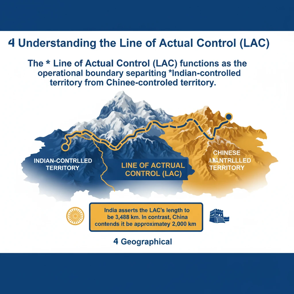
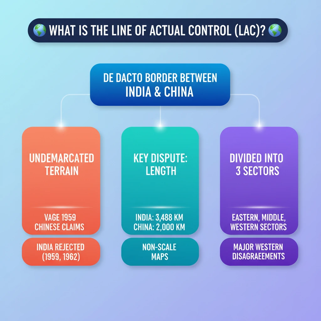
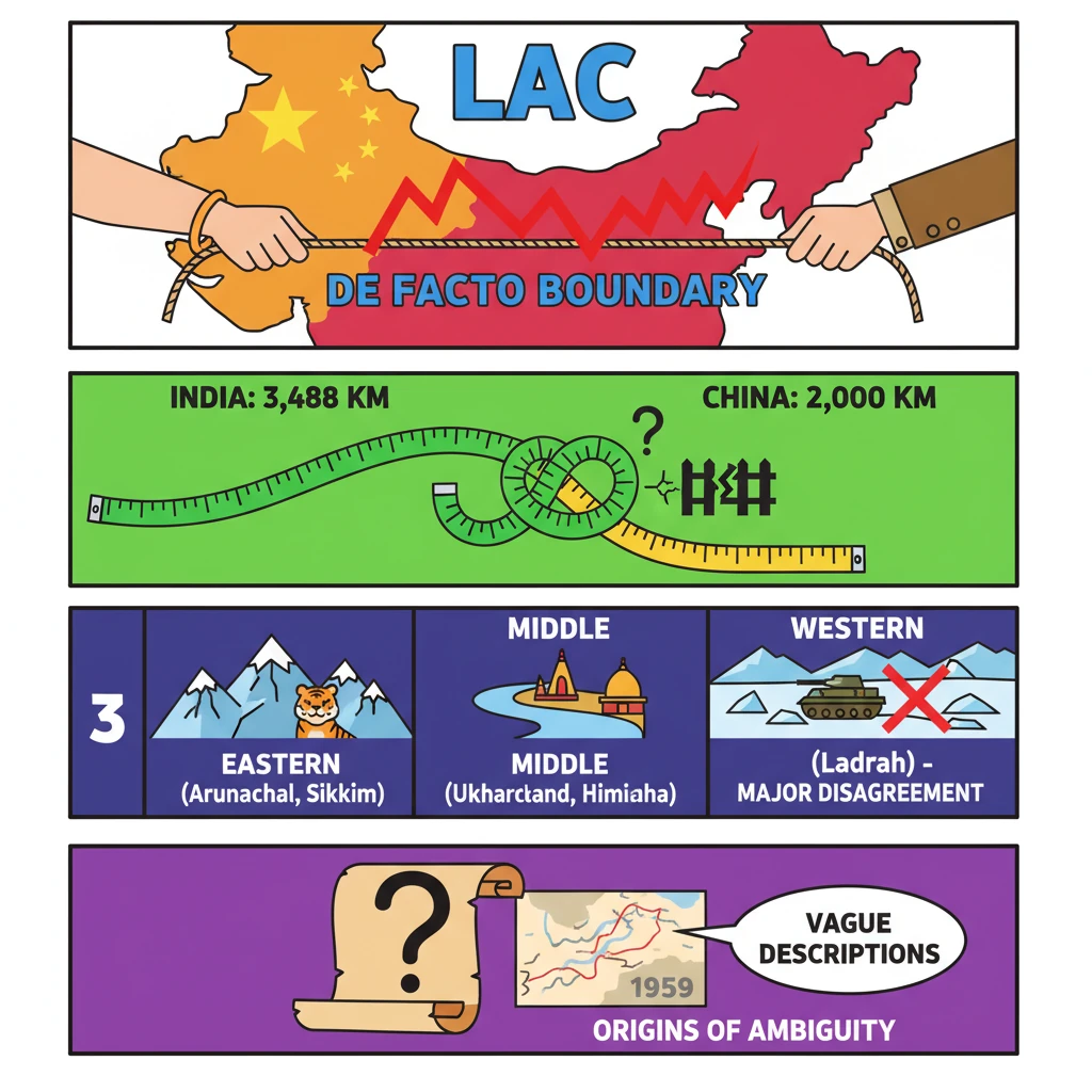
<h4>Understanding the Line of Actual Control (LAC)</h4><p>The <strong>Line of Actual Control (LAC)</strong> functions as the operational boundary separating <strong>Indian-controlled territory</strong> from <strong>Chinese-controlled territory</strong>.</p><div class="info-box"><p><strong>India</strong> asserts the <strong>LAC's length</strong> to be <strong>3,488 km</strong>. In contrast, <strong>China</strong> contends it to be approximately <strong>2,000 km</strong>.</p></div><h4>Geographical Demarcation of the LAC</h4><p>This demarcation is traditionally categorized into <strong>three distinct sectors</strong>, each with its unique geographical and historical context.</p><ul><li><strong>Eastern sector</strong>: Encompasses the regions of <strong>Arunachal Pradesh</strong> and <strong>Sikkim</strong>.</li><li><strong>Middle sector</strong>: Spans across <strong>Uttarakhand</strong> and <strong>Himachal Pradesh</strong>.</li><li><strong>Western sector</strong>: Primarily located in the strategically crucial region of <strong>Ladakh</strong>.</li></ul><h4>Core Disagreements Regarding the LAC</h4><p>The fundamental dispute surrounding the <strong>LAC</strong> stems from differing perceptions of its <strong>precise alignment</strong> across these various sectors.</p><p>In the <strong>eastern sector</strong>, the <strong>LAC</strong> generally follows the historically significant <strong>1914 McMahon Line</strong>, with only minor disagreements concerning specific ground positions.</p><p>However, <strong>major disagreements</strong> are concentrated in the <strong>Western sector</strong>. These disputes trace their origins back to letters exchanged between <strong>Chinese Prime Minister Zhou Enlai</strong> and <strong>Indian Prime Minister Jawahar Nehru</strong> in <strong>1959</strong>.</p><div class="key-point-box"><p>The <strong>Chinese</strong> initially described the <strong>LAC</strong> only in <strong>general terms</strong> on maps that were <strong>not to scale</strong>, contributing significantly to its inherent ambiguity.</p></div><p>Following the <strong>1962 War</strong>, <strong>China</strong> claimed to have withdrawn its forces <strong>20 km behind the LAC</strong> in <strong>November 1959</strong>, a claim that further complicated the understanding of its actual position.</p><p>During the <strong>Doklam crisis</strong> in <strong>2017</strong>, the <strong>Chinese Foreign Ministry spokesperson</strong> urged <strong>India</strong> to abide by the <strong>“1959 LAC”</strong>, further highlighting the persistent ambiguity.</p><p>Despite subsequent clarifications, this ambiguity has persisted, leading to <strong>contrasting interpretations</strong> by both nations regarding the LAC's true alignment.</p><h4>India's Evolving Stance on the LAC</h4><p>Initially, <strong>India rejected</strong> the concept of the <strong>LAC</strong> in both <strong>1959</strong> and <strong>1962</strong>.</p><p>This rejection was primarily due to concerns over its <strong>vague definition</strong> and the potential for <strong>China</strong> to exploit this ambiguity to alter <strong>ground realities</strong> through military force.</p><p>A significant shift in <strong>India's approach</strong> to the <strong>LAC</strong> began in the <strong>mid-1980s</strong>. This change was prompted by an increase in <strong>border encounters</strong>, necessitating a review of patrolling boundaries and a more pragmatic engagement with the concept.</p><div class="exam-tip-box"><p>Understanding the historical evolution of <strong>India's stance</strong> on the <strong>LAC</strong> is crucial for analyzing current <strong>India-China relations</strong> in <strong>UPSC Mains GS-2 (International Relations)</strong>.</p></div>
💡 Key Takeaways
- •The LAC is the de facto boundary separating Indian and Chinese controlled territories.
- •India claims LAC is 3,488 km, China claims 2,000 km, highlighting a key dispute.
- •It is divided into three sectors: Eastern (Arunachal, Sikkim), Middle (Uttarakhand, Himachal), and Western (Ladakh), with major disagreements in the Western sector.
- •The LAC's ambiguity originates from vague Chinese descriptions in 1959, using non-scale maps.
- •India initially rejected the LAC (1959, 1962) due to its undefined nature, but shifted its approach in the mid-1980s for pragmatic border management.
- •Incidents like Doklam (2017) and Galwan (2020) exemplify the persistent tensions and differing perceptions along the LAC.
🧠 Memory Techniques
95% Verified Content
📚 Reference Sources
•General knowledge on India-China border disputes