Types of landslides - Geography | UPSC Learning
Topics
0 topics • 0 completed
🔍
No topics match your search
Types of landslides
Medium⏱️ 8 min read
geography
📖 Introduction
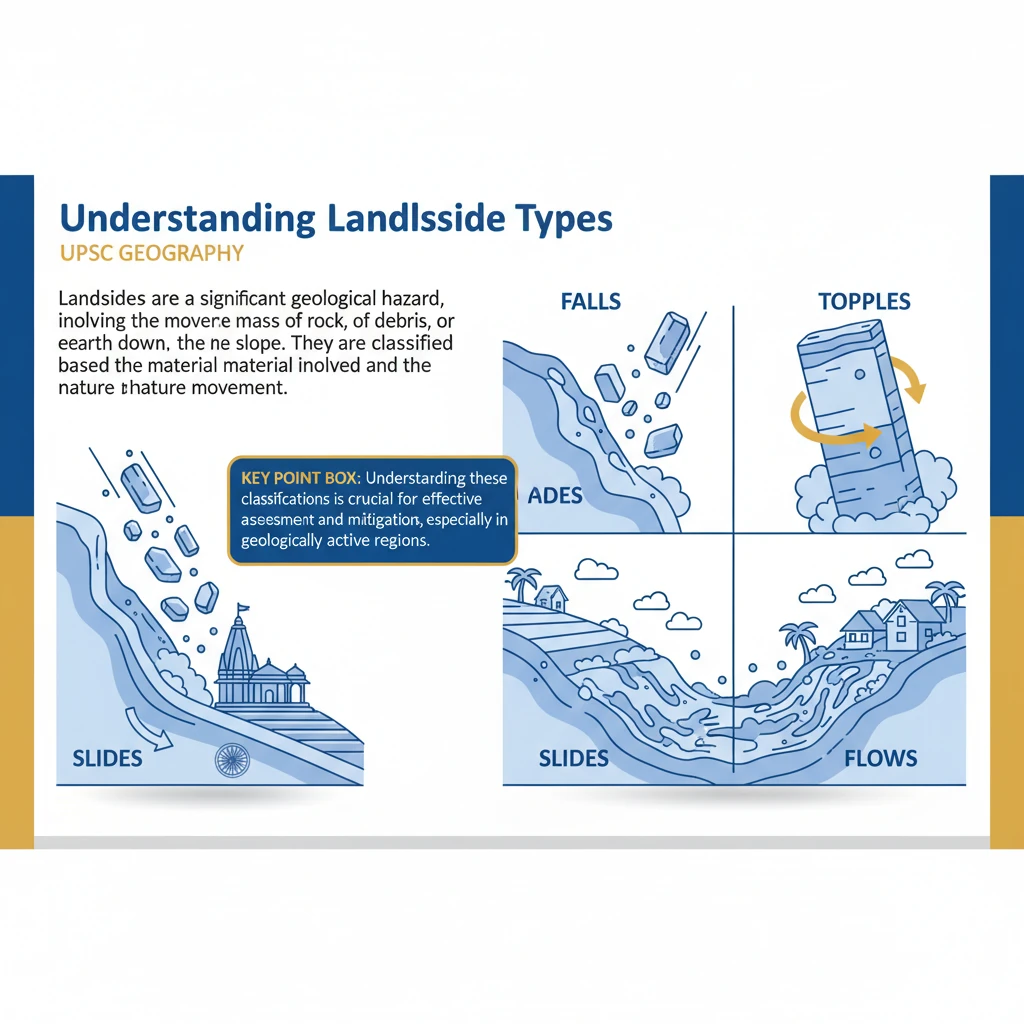
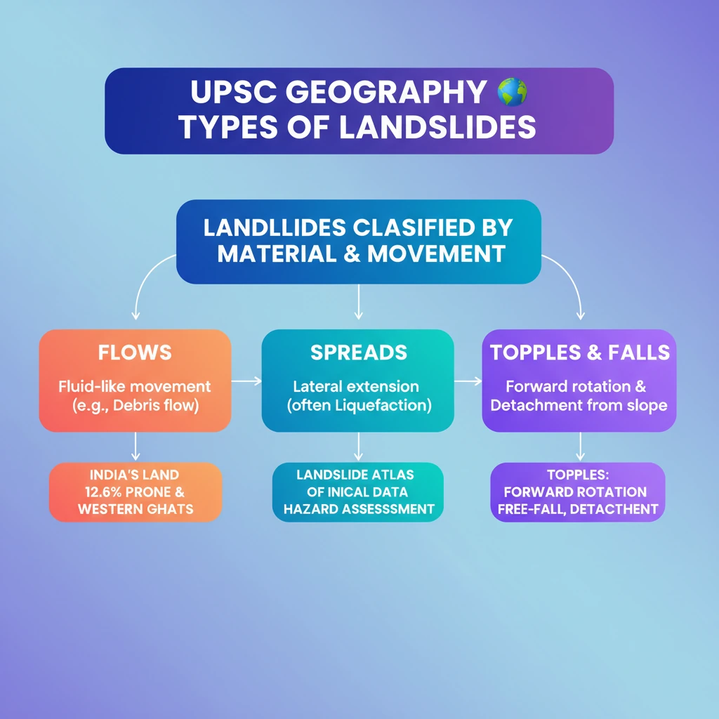
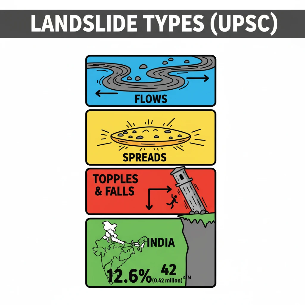
<h4>Understanding Landslide Types</h4><p><strong>Landslides</strong> are a significant geological hazard, involving the movement of a mass of rock, debris, or earth down a slope. They are broadly classified based on the type of material involved and the nature of movement.</p><div class='key-point-box'><p>Understanding these classifications is crucial for effective <strong>hazard assessment</strong> and <strong>mitigation strategies</strong>, especially in geologically active regions.</p></div><h4>Flows</h4><p><strong>Flows</strong> describe landslides where soil or rock material mixes with water, moving downslope like a viscous fluid. This category encompasses several distinct phenomena.</p><ul><li><strong>Earth Flows:</strong> Slow to rapid movement of fine-grained soil.</li><li><strong>Debris Flows:</strong> Rapid movement of a mixture of water, soil, and rock fragments.</li><li><strong>Mudflows:</strong> Very rapid flow of water-saturated fine-grained material.</li><li><strong>Creep:</strong> Extremely slow, imperceptible downslope movement of soil and rock, often influenced by freeze-thaw cycles.</li></ul><h4>Spreads</h4><p><strong>Spreads</strong> involve the lateral extension and cracking of a ground mass. This type of movement often occurs on gentle slopes or flat terrain due to the <strong>liquefaction</strong> of underlying saturated granular materials like sand.</p><div class='info-box'><p><strong>Liquefaction</strong> is a phenomenon where saturated, loose granular soil temporarily loses strength and stiffness, behaving like a liquid due to applied stress, typically from an earthquake or rapid loading.</p></div><h4>Topples</h4><p><strong>Topples</strong> are characterized by the forward rotation and free-fall of a mass of rock or earth from a vertical or near-vertical slope. This typically happens when the center of gravity of a block of material moves beyond its base of support.</p><div class='key-point-box'><p><strong>Toppling failures</strong> are common in areas with steeply dipping rock strata or heavily jointed rock masses, leading to sudden and dangerous collapses.</p></div><h4>Falls</h4><p><strong>Falls</strong> involve the detachment of rock or earth material from a steep slope or cliff face. The detached material then descends primarily by <strong>free-fall</strong>, but can also involve bouncing or rolling down the slope.</p><div class='info-box'><p><strong>Rockfalls</strong> are a common example of falls, frequently triggered by weathering, earthquakes, or heavy rainfall, especially in mountainous regions.</p></div><h4>Landslide Prone Areas in India</h4><p>India, with its diverse geological and topographical features, has significant areas vulnerable to landslides. The <strong>Landslide Atlas of India</strong> provides crucial data on these susceptible regions.</p><div class='info-box'><p>According to the <strong>Landslide Atlas of India</strong>, approximately <strong>0.42 million sq. km</strong>, which constitutes about <strong>12.6%</strong> of the country's total land area, is prone to landslides.</p></div><p>The distribution of these prone areas highlights specific geological and climatic vulnerabilities across different regions:</p><ul><li><strong>North East Himalaya:</strong> Approximately <strong>0.18 million sq. km</strong>.</li><li><strong>North West Himalaya:</strong> Approximately <strong>0.14 million sq. km</strong>.</li><li><strong>Western Ghats and Konkan Hills:</strong> Approximately <strong>0.09 million sq. km</strong>.</li><li><strong>Eastern Ghats of Andhra Pradesh:</strong> Approximately <strong>0.01 million sq. km</strong>.</li></ul><div class='exam-tip-box'><p>Knowledge of these <strong>landslide-prone regions</strong> is vital for UPSC Mains answers, particularly in <strong>Geography (GS Paper I)</strong> and <strong>Disaster Management (GS Paper III)</strong>. Be prepared to discuss their causes and mitigation strategies.</p></div>
💡 Key Takeaways
- •Landslides are classified into Flows, Spreads, Topples, and Falls based on material and movement.
- •Flows involve fluid-like movement (e.g., debris flows); Spreads are lateral extensions often due to liquefaction.
- •Topples are forward rotations and free-falls; Falls are detachments from steep slopes.
- •Approximately 12.6% (0.42 million sq. km) of India's land area is landslide-prone, concentrated in the Himalayas and Western Ghats.
- •The Landslide Atlas of India provides critical data for hazard assessment.
- •Understanding landslide types is crucial for effective disaster management and mitigation strategies.
🧠 Memory Techniques
95% Verified Content
📚 Reference Sources
•Geological Survey of India (GSI) reports on landslides
•National Disaster Management Authority (NDMA) guidelines
•ISRO's Landslide Atlas of India