What is Deep Sea Bed Mining? - Geography | UPSC Learning
Topics
0 topics • 0 completed
🔍
No topics match your search
What is Deep Sea Bed Mining?
Medium⏱️ 8 min read
geography
📖 Introduction
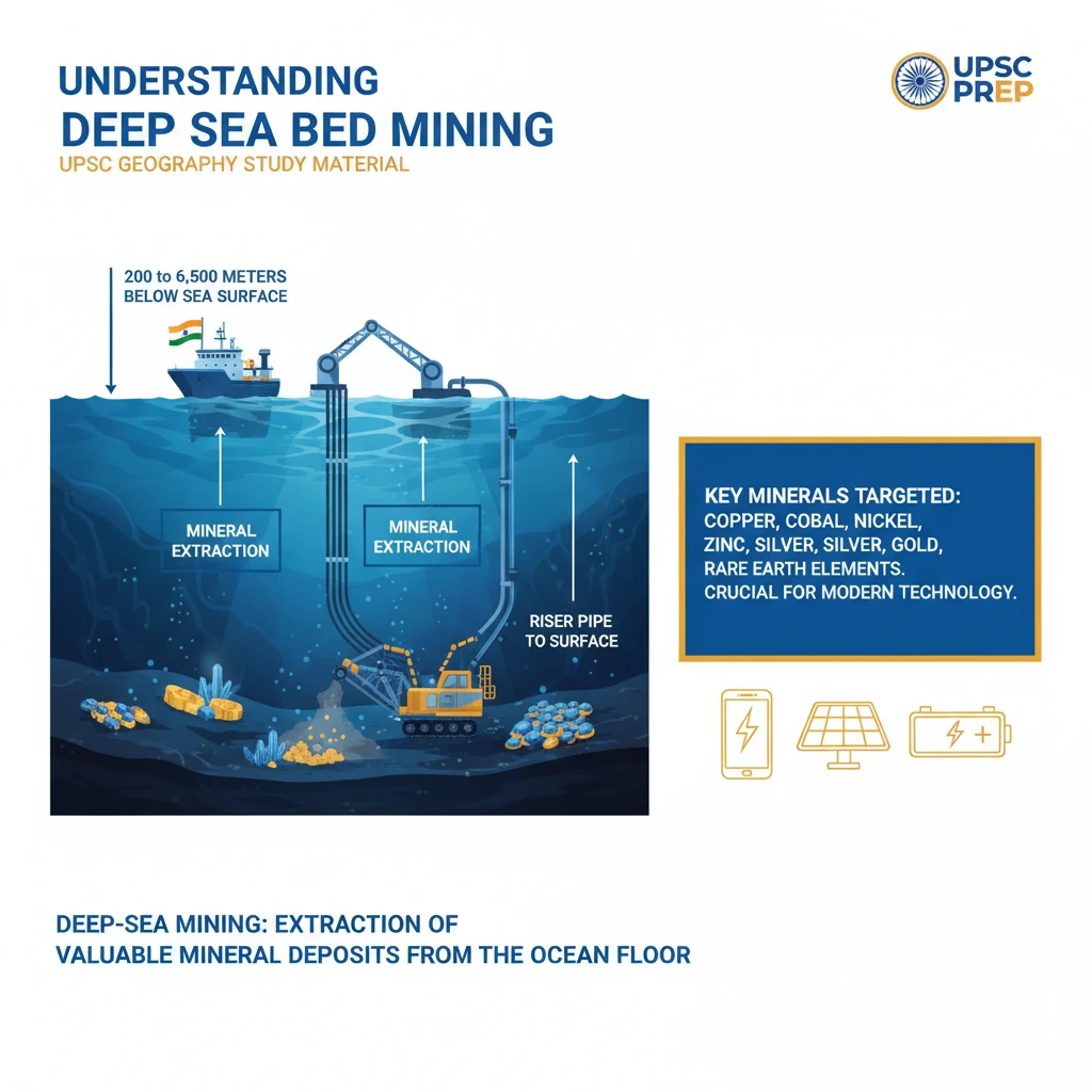
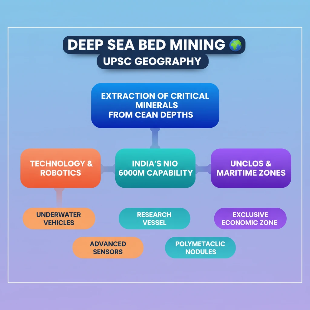
<h4>Understanding Deep Sea Bed Mining</h4><p><strong>Deep-sea mining</strong> involves the extraction of valuable <strong>mineral deposits</strong> from the ocean floor. These operations occur at significant depths, typically ranging from <strong>200 to 6,500 meters</strong> below the sea surface.</p><div class='info-box'><p>Key minerals targeted include <strong>copper, cobalt, nickel, zinc, silver, gold</strong>, and various <strong>rare earth elements</strong>. These are crucial for modern technologies and green energy solutions.</p></div><h4>Technological Advancements and Feasibility</h4><p>Historically, establishing <strong>deep-sea mines</strong> was considered far more expensive than traditional land-based mining. This economic barrier limited early exploration and development.</p><p>However, significant innovations in <strong>underwater robotics</strong>, largely stemming from the <strong>petroleum industry</strong>, have dramatically improved the prospects and feasibility of deep-sea mining operations.</p><h4>India's Role: National Institute of Oceanography (NIO)</h4><p>India, through the <strong>National Institute of Oceanography (NIO)</strong>, is actively involved in deep-sea research and technology development. <strong>NIO</strong> has successfully tested deep-sea mining systems.</p><div class='info-box'><p><strong>NIO</strong> has conducted tests for deep-sea mining systems up to a depth of <strong>512 meters</strong>. The institute is currently working on developing more advanced systems capable of operating at depths of up to <strong>6,000 meters</strong>.</p></div><h4>Defining Maritime Zones: The Baseline Concept</h4><p>A <strong>baseline</strong> is a crucial reference line used in <strong>international maritime law</strong>. It serves as the starting point for measuring the outer boundaries of a state’s various <strong>maritime zones</strong>.</p><div class='key-point-box'><p>These zones include the <strong>territorial sea, contiguous zone, exclusive economic zone (EEZ)</strong>, and the <strong>continental shelf</strong>, each granting different rights and jurisdictions to the coastal state.</p></div><h4>Establishing Baselines: Standard and Exceptions</h4><p>Typically, the <strong>baseline</strong> mirrors the <strong>low-water mark</strong> along the natural coastline of the coastal state. This is the most common method for determining maritime boundaries.</p><p>However, in specific geographical circumstances, <strong>straight baselines</strong> may be established. These are drawn across features like deeply indented coastlines, groups of islands close to the shore, or highly unstable coastlines.</p><div class='exam-tip-box'><p>Understanding <strong>baselines</strong> and <strong>maritime zones</strong> is fundamental for questions on <strong>UNCLOS (United Nations Convention on the Law of the Sea)</strong> in <strong>GS Paper II</strong> (International Relations) and <strong>GS Paper I</strong> (Geography).</p></div>
💡 Key Takeaways
- •Deep-sea mining extracts critical minerals (e.g., copper, cobalt, rare earths) from ocean depths of 200-6500m.
- •Technological advancements, especially in underwater robotics, have made deep-sea mining more viable.
- •India's NIO is actively developing deep-sea mining systems, aiming for 6,000m depth capability.
- •Baselines are fundamental reference lines for defining a nation's maritime zones (territorial sea, EEZ) under UNCLOS.
- •Deep-sea mining presents a balance between strategic resource security and significant environmental and regulatory challenges.
🧠 Memory Techniques

95% Verified Content
📚 Reference Sources
•United Nations Convention on the Law of the Sea (UNCLOS) principles
•International Seabed Authority (ISA) information
•General knowledge of oceanography and resource extraction