Wildfires Triggering Pyrocumulonimbus Clouds - Geography | UPSC Learning
Topics
0 topics • 0 completed
🔍
No topics match your search
Wildfires Triggering Pyrocumulonimbus Clouds
Medium⏱️ 8 min read
geography
📖 Introduction
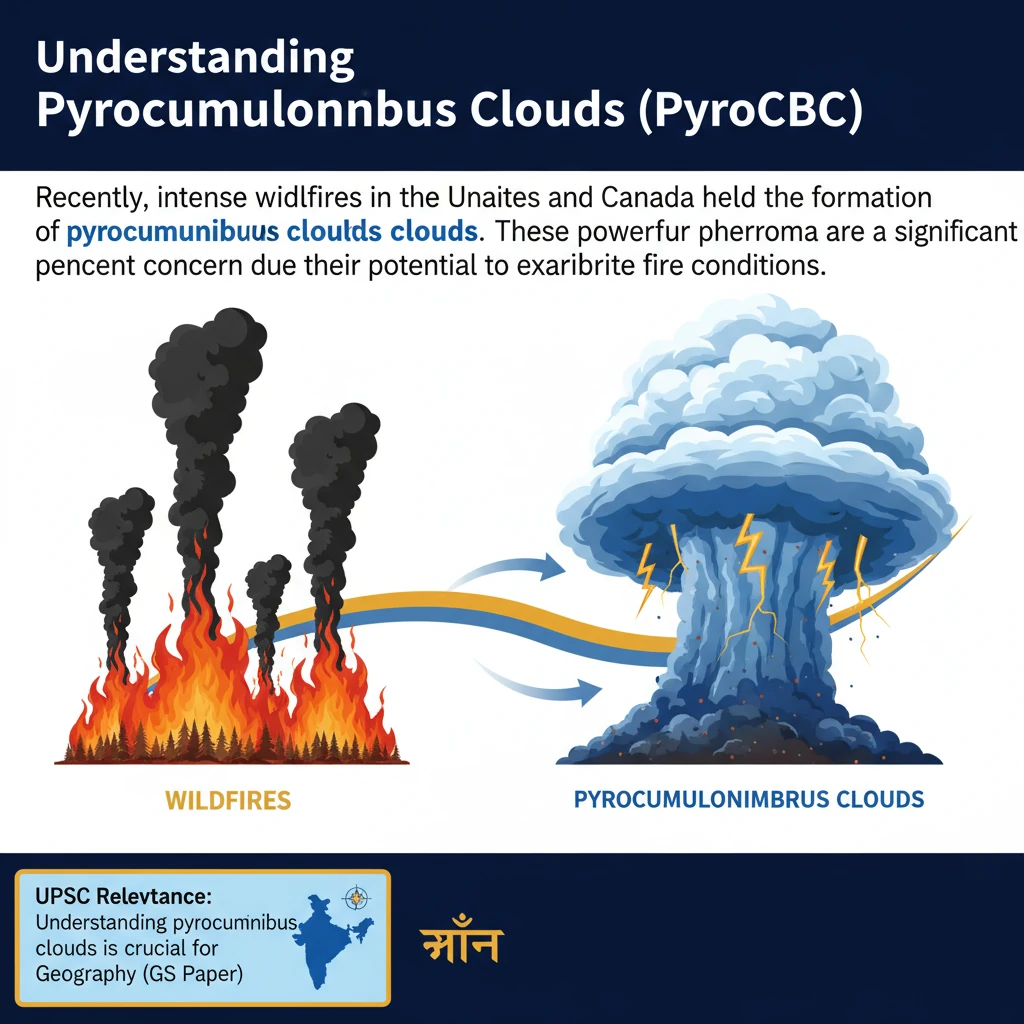
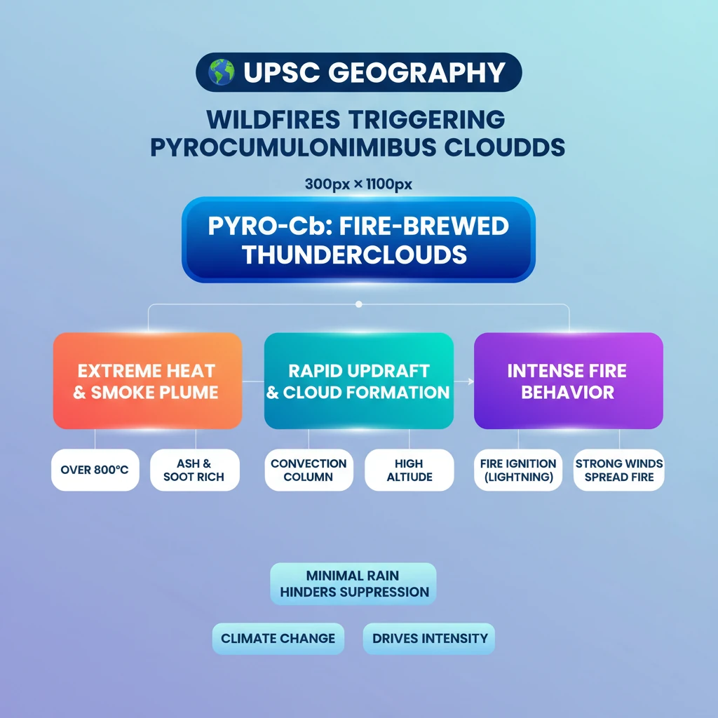
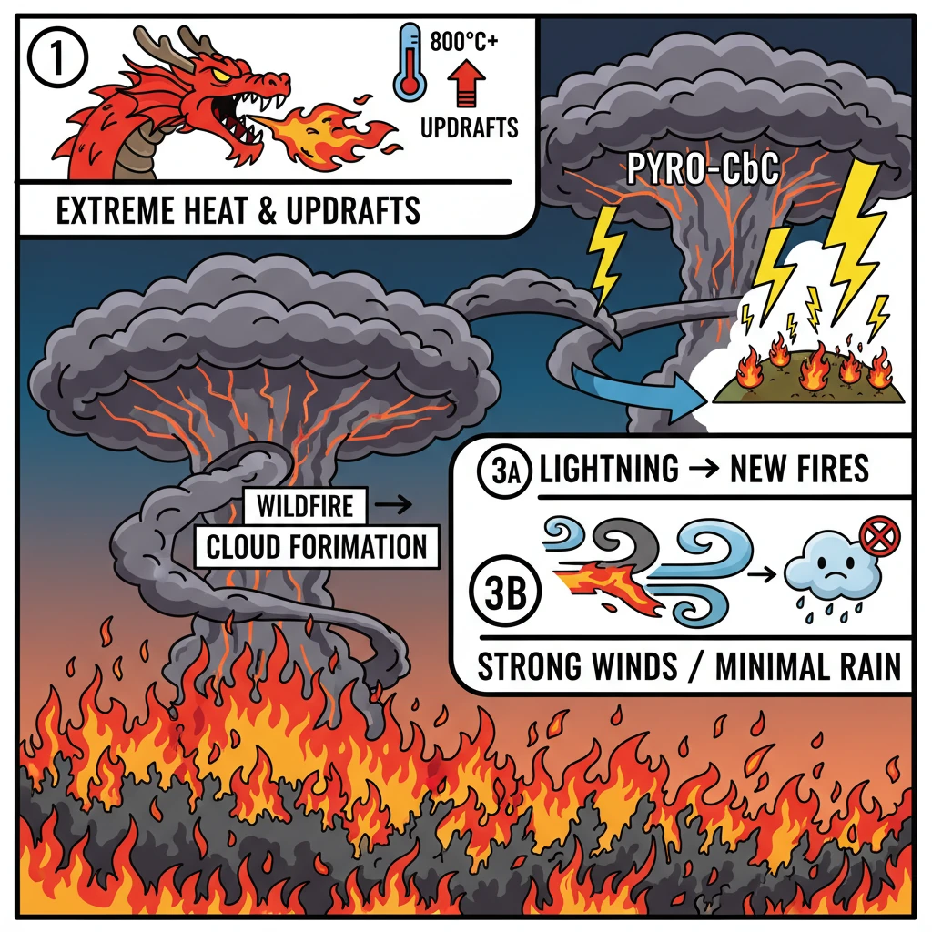
<h4>Understanding Pyrocumulonimbus Clouds (PyroCbCs)</h4><p>Recently, intense wildfires in the <strong>United States</strong> and <strong>Canada</strong> have led to the formation of <strong>pyrocumulonimbus clouds</strong>. These powerful weather phenomena are a significant concern due to their potential to exacerbate fire conditions.</p><div class='exam-tip-box'><p><strong>UPSC Relevance:</strong> Understanding <strong>pyrocumulonimbus clouds</strong> is crucial for <strong>Geography (GS Paper I)</strong>, especially under topics like climatology, atmospheric phenomena, and disaster management. It also connects to <strong>Environment (GS Paper III)</strong> regarding climate change impacts and wildfire management.</p></div><h4>What are Pyrocumulonimbus Clouds?</h4><div class='info-box'><p><strong>Definition:</strong> <strong>Pyrocumulonimbus clouds (PyroCbCs)</strong> are essentially <strong>thunder clouds</strong> that are generated by the intense heat emanating from the Earth's surface, primarily from large <strong>wildfires</strong> or <strong>volcanic eruptions</strong>. They are often referred to as <strong>fire clouds</strong>.</p></div><p>Their formation process is analogous to regular <strong>cumulonimbus clouds</strong>. However, the critical difference lies in the source of the vigorous updraft, which in this case, is the extreme heat from a fire event rather than conventional atmospheric instability.</p><h4>Conditions for PyroCbC Formation</h4><p>The development of <strong>pyrocumulonimbus clouds</strong> requires conditions of extreme heat. Not every wildfire will produce these clouds; specific temperature thresholds must be met for their initiation.</p><ul><li><strong>Extreme Heat:</strong> The primary trigger is an exceptionally hot source, such as a large-scale <strong>wildfire</strong> or a <strong>volcanic eruption</strong>.</li><li><strong>Temperature Threshold:</strong> Temperatures generally need to exceed <strong>800°C</strong> for these clouds to form. A notable instance was during the <strong>2019-2020 Australian bushfires</strong>, where such conditions were prevalent.</li><li><strong>Rapid Air Rise:</strong> The intense heat from the fire causes a rapid and powerful updraft of hot air. This rising air carries with it <strong>water vapour</strong>, <strong>smoke</strong>, and <strong>ash</strong>.</li><li><strong>Condensation and Cloud Growth:</strong> As this hot, smoke-laden air ascends and cools, the water vapour condenses around the smoke and ash particles, forming <strong>pyrocumulus clouds</strong>. If the updraft is strong enough, these can develop into full-fledged <strong>pyrocumulonimbus clouds</strong>.</li><li><strong>Altitude and Thunderstorm Systems:</strong> These clouds can reach significant altitudes, often up to <strong>50,000 feet</strong>. At these heights, they can evolve into self-sustaining <strong>thunderstorm systems</strong>, complete with <strong>lightning</strong> and strong, turbulent winds.</li></ul><h4>Impacts and Characteristics of PyroCbCs</h4><p>The formation of <strong>pyrocumulonimbus clouds</strong> has several critical impacts, primarily worsening wildfire conditions and complicating suppression efforts.</p><ul><li><strong>Lightning Ignition:</strong> A major concern is the production of <strong>lightning</strong> by these clouds. This lightning can strike several kilometres away from the original fire, igniting <strong>new wildfires</strong> and expanding the disaster zone.</li><li><strong>Minimal Rain Production:</strong> Despite being thunderclouds, <strong>pyrocumulonimbus clouds</strong> typically generate very little rain. The moisture is often evaporated before reaching the ground, meaning they aid in <strong>wildfire spread</strong> rather than suppression.</li><li><strong>Strong Winds:</strong> These clouds are associated with generating powerful and erratic winds. Such winds can significantly <strong>accelerate wildfire spread</strong>, making fire management extremely difficult and dangerous for firefighters.</li><li><strong>Smoke and Ash Dispersion:</strong> PyroCbCs are highly effective at lofting smoke and ash high into the atmosphere, which can then be transported over vast distances, impacting air quality far from the fire source.</li></ul>
💡 Key Takeaways
- •Pyrocumulonimbus clouds (PyroCbCs) are thunderclouds formed by intense heat from large wildfires or volcanic eruptions.
- •They require extreme heat (over 800°C) and strong updrafts of hot, smoke-laden air to form.
- •PyroCbCs can generate lightning, igniting new fires, and produce strong winds, accelerating fire spread.
- •Despite being thunderclouds, they typically produce minimal rain, hindering fire suppression.
- •Their increasing occurrence is linked to more intense wildfires, often exacerbated by climate change.
🧠 Memory Techniques
95% Verified Content