Tsangyang Gyatso Peak - Geography | UPSC Learning
Topics
0 topics • 0 completed
🔍
No topics match your search
Tsangyang Gyatso Peak
Medium⏱️ 7 min read
geography
📖 Introduction
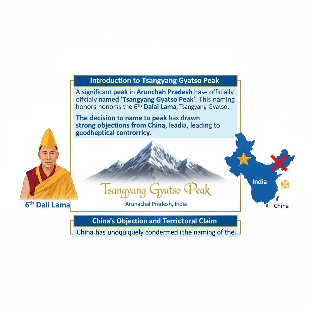
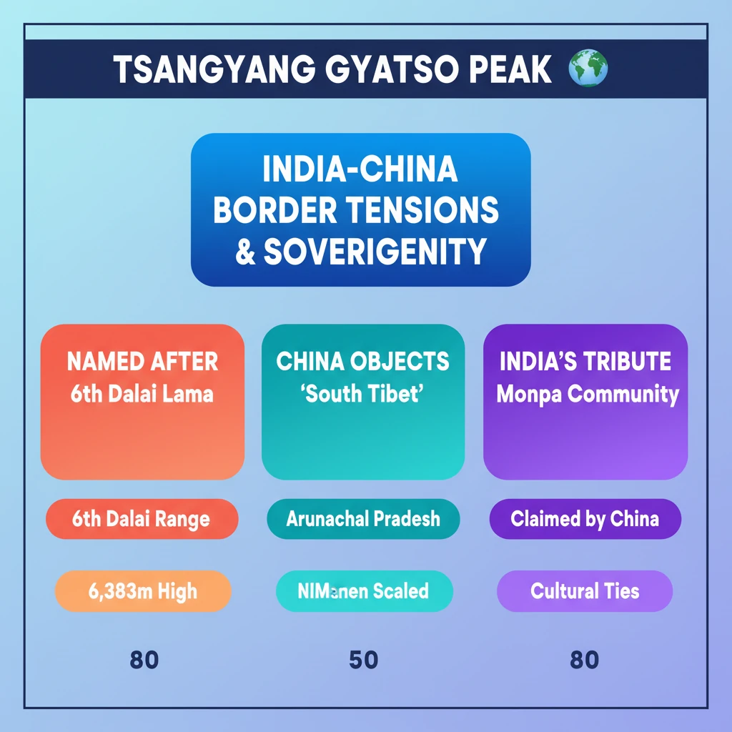
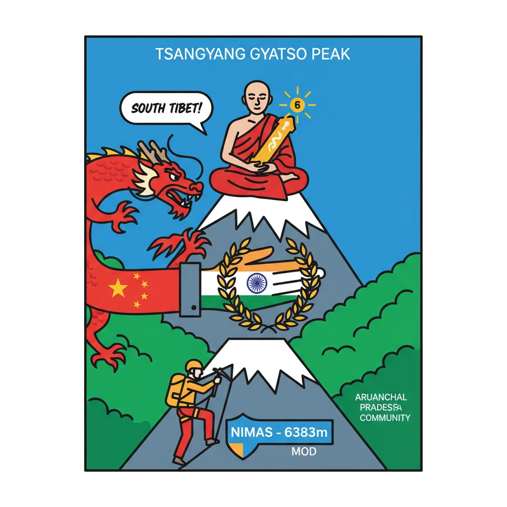
<h4>Introduction to Tsangyang Gyatso Peak</h4><p>A significant peak in <strong>Arunachal Pradesh</strong> has been officially named <strong>“Tsangyang Gyatso Peak”</strong>. This naming honors the <strong>6th Dalai Lama, Tsangyang Gyatso</strong>.</p><p>The decision to name the peak has drawn strong objections from <strong>China</strong>, leading to a geopolitical controversy.</p><h4>China's Objection and Territorial Claim</h4><p><strong>China</strong> has unequivocally condemned the naming of the peak. Beijing views this act as an <strong>illegal operation</strong> conducted within what it claims to be <strong>“Chinese territory”</strong>.</p><p>The Chinese government asserts its claim over the entire state of <strong>Arunachal Pradesh</strong>, referring to it as <strong>“South Tibet”</strong>. In the Chinese language, this region is designated as <strong>“Zangnan”</strong>.</p><div class='info-box'><p><strong>China's Claim:</strong> The entire <strong>Arunachal Pradesh</strong> is claimed as <strong>South Tibet</strong>, also known as <strong>Zangnan</strong>.</p></div><h4>India's Rationale for Naming</h4><p><strong>India</strong> has clarified its position, stating that the naming of the peak serves as a heartfelt tribute to <strong>Tsangyang Gyatso’s</strong> <strong>“timeless wisdom”</strong>.</p><p>Furthermore, it acknowledges his profound contributions to the <strong>Monpa community</strong>, an important ethnic group indigenous to the <strong>Tawang region</strong> of <strong>Arunachal Pradesh</strong>.</p><h4>Geographical Location and Features</h4><p>The <strong>Tsangyang Gyatso Peak</strong> is situated within the majestic <strong>Gorichen range</strong>. This range is an integral part of the <strong>Arunachal Pradesh Himalayas</strong>.</p><div class='info-box'><p><strong>Peak Location:</strong> <strong>Gorichen range</strong>, <strong>Arunachal Pradesh Himalayas</strong>.</p><p><strong>Peak Height:</strong> <strong>6,383 meters</strong>.</p></div><h4>The NIMAS Expedition</h4><p>A specialized team from the <strong>National Institute of Mountaineering and Adventure Sports (NIMAS)</strong> successfully scaled the <strong>6,383-meter peak</strong>.</p><p>The expedition faced formidable challenges, including navigating <strong>steep ice walls</strong>, treacherous <strong>dangerous crevasses</strong>, and a sprawling <strong>two-kilometer long glacier</strong>.</p><h4>About NIMAS</h4><p>The <strong>National Institute of Mountaineering and Adventure Sports (NIMAS)</strong> is a premier institution in India. It operates under the direct purview and administration of the <strong>Ministry of Defence</strong>.</p><div class='key-point-box'><p><strong>NIMAS Affiliation:</strong> Functions under the <strong>Ministry of Defence</strong>, Government of India.</p></div>
💡 Key Takeaways
- •Tsangyang Gyatso Peak in Arunachal Pradesh is named after the 6th Dalai Lama, Tsangyang Gyatso.
- •China objects to the naming, claiming Arunachal Pradesh as 'South Tibet' (Zangnan).
- •India views the naming as a tribute to Tsangyang Gyatso's wisdom and his contributions to the Monpa community.
- •The peak is 6,383m high, located in the Gorichen range, and was scaled by NIMAS (under Ministry of Defence).
- •The incident underscores the ongoing India-China border tensions and India's assertion of sovereignty and cultural ties in the region.
🧠 Memory Techniques
95% Verified Content