What are the Methods Adopted by the ASI for Excavation? - Art And Culture | UPSC Learning
Topics
0 topics • 0 completed
🔍
No topics match your search
What are the Methods Adopted by the ASI for Excavation?
Medium⏱️ 8 min read
art and culture
📖 Introduction
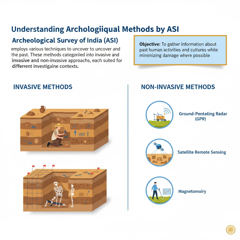
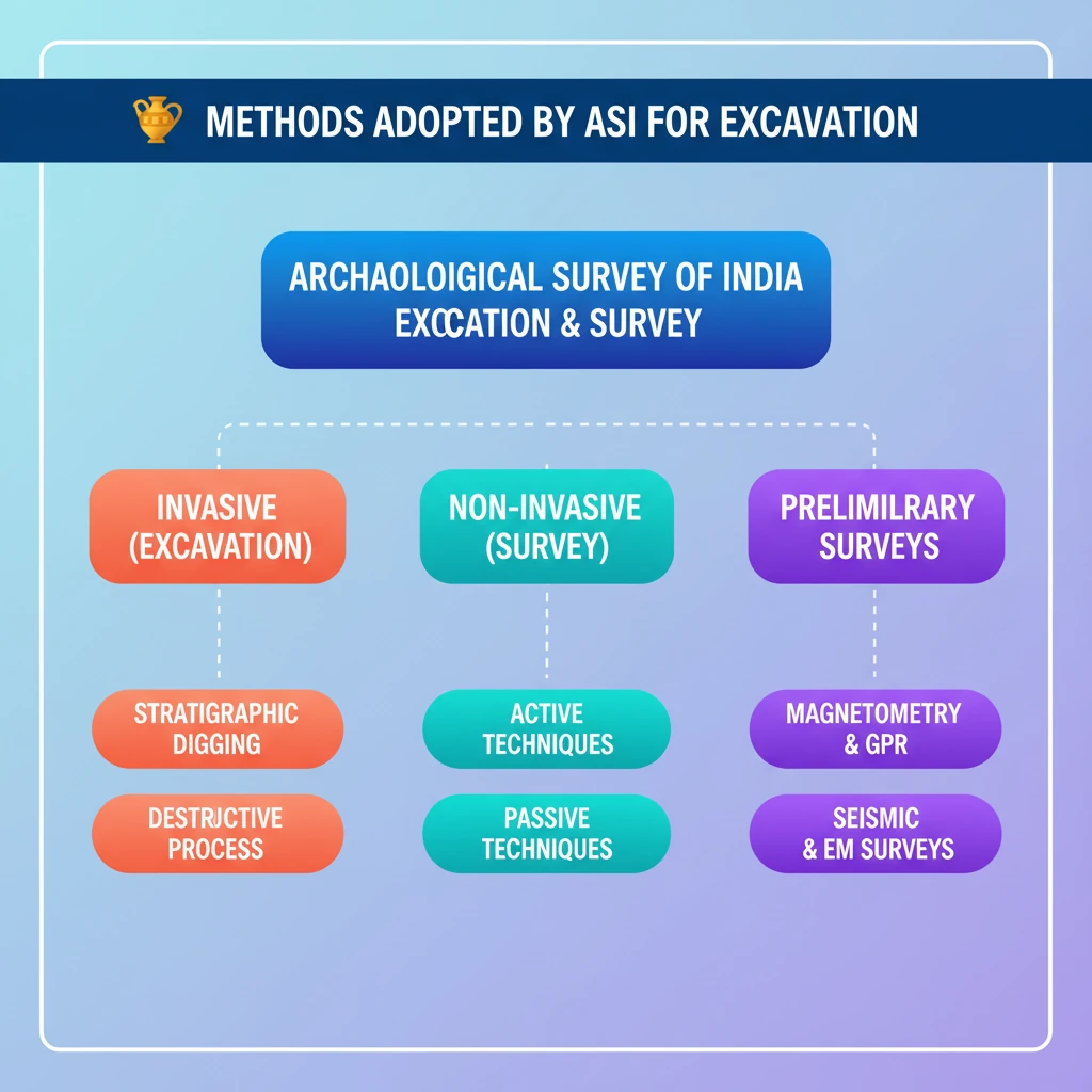
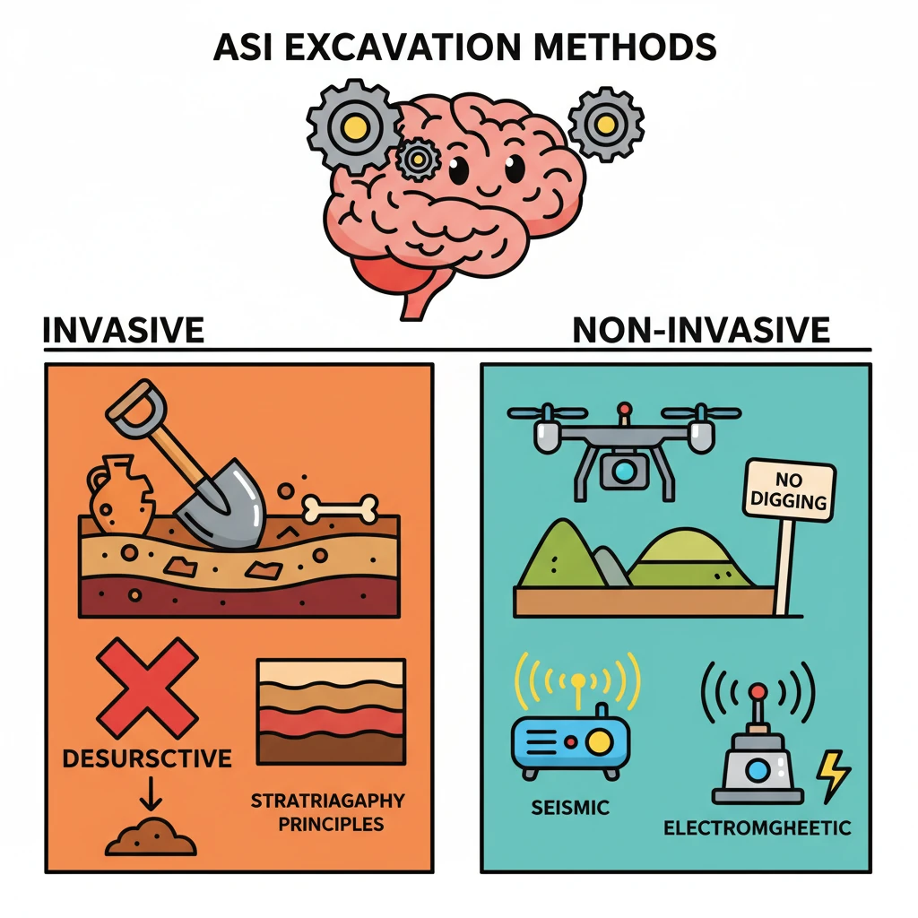
<h4>Understanding Archaeological Methods by ASI</h4><p>The <strong>Archaeological Survey of India (ASI)</strong> employs various techniques to uncover and understand the past. These methods are broadly categorized into <strong>invasive</strong> and <strong>non-invasive</strong> approaches, each suited for different investigative contexts.</p><div class="key-point-box"><strong>Objective:</strong> To gather information about past human activities and cultures while minimizing damage where possible.</div><h4>Invasive Archaeological Methods: Excavation</h4><p><strong>Excavation</strong> is the most prominent <strong>invasive archaeological technique</strong>. It involves the systematic digging of archaeological sites to uncover buried remains and structures. While crucial for data recovery, it inherently leads to the destruction of the archaeological context as layers are removed.</p><div class="info-box"><strong>Principle:</strong> Based on <strong>stratigraphic principles</strong>, which involves peeling off layers in reverse order of their deposition to understand the chronological sequence and formation of the archaeological record.</div><p>Archaeologists carefully document each layer (stratum) and the artifacts found within it, providing a chronological framework for the site's history.</p><h4>Non-Invasive Archaeological Methods</h4><p><strong>Non-invasive methods</strong> are employed when physical excavation is not permitted or desired, particularly within existing built structures or for initial site surveys. These techniques allow for investigation without disturbing the ground or structure.</p><div class="key-point-box"><strong>Advantage:</strong> Allows for preliminary assessment, site mapping, and investigation in sensitive areas without causing physical damage.</div><h5>Active Non-Invasive Methods</h5><p>These methods involve injecting energy into the ground and then measuring the response. This helps estimate the ground's material properties, such as density, electrical resistance, and wave velocity.</p><ul><li><strong>Seismic Techniques:</strong> These methods use controlled <strong>shock waves</strong> (acoustic energy) to study subsurface structures. The reflection and refraction of these waves provide information about different layers and anomalies beneath the surface.</li><li><strong>Electromagnetic Methods:</strong> These techniques measure the <strong>electromagnetic responses</strong> of the ground after energy injection. Variations in electrical conductivity or magnetic susceptibility can indicate buried features like walls, ditches, or metal objects.</li></ul><h5>Passive Non-Invasive Methods</h5><p>Passive methods involve measuring existing physical properties of the earth without introducing external energy.</p><ul><li><strong>Magnetometry:</strong> This technique detects <strong>magnetic anomalies</strong> caused by buried structures. Features like hearths, kilns, or even ditches can alter the local magnetic field, which magnetometers can then detect.</li><li><strong>Gravity Surveying:</strong> Measures variations in the <strong>gravitational force</strong> due to subsurface features. Denser materials (like stone walls) or less dense materials (like filled-in pits) can create detectable gravitational differences.</li></ul><h5>Specialized Non-Invasive Techniques</h5><p>The ASI utilizes advanced tools for detailed subsurface imaging.</p><ul><li><strong>Ground-Penetrating Radar (GPR):</strong> The <strong>ASI</strong> frequently uses <strong>GPR</strong> to produce a <strong>3-D model</strong> of buried archaeological features. It works by introducing a short <strong>radar impulse</strong> from a surface antenna and recording the time and magnitude of return signals from the subsoil.</li></ul><div class="info-box"><strong>GPR Mechanism:</strong><ul><li>A radar beam spreads like a cone, causing reflections even before the antenna passes directly over an object.</li><li>This 'cone effect' can lead to reflections that may not directly correspond to physical dimensions, potentially creating false images or requiring careful interpretation.</li></ul></div><h5>Dating Method: Carbon Dating</h5><p><strong>Carbon Dating</strong> is a crucial method used to determine the age of <strong>organic materials</strong>. It measures the remaining content of the radioactive isotope <strong>Carbon-14 (C-14)</strong> in a sample. The decay rate of C-14 is known, allowing archaeologists to calculate how long ago an organism died.</p><div class="exam-tip-box"><strong>UPSC Relevance:</strong> Understanding the difference between invasive and non-invasive methods is critical for <strong>GS-I (Art & Culture, History)</strong>. Be prepared to discuss the pros and cons of each and specific applications by ASI.</div>
💡 Key Takeaways
- •Archaeological methods are categorized into invasive (excavation) and non-invasive techniques.
- •Excavation is invasive, involving digging based on stratigraphic principles, and inherently destructive.
- •Non-invasive methods are used when excavation is not permitted or for preliminary surveys.
- •Active non-invasive methods inject energy into the ground (Seismic, Electromagnetic).
- •Passive non-invasive methods measure existing physical properties (Magnetometry, Gravity Surveying).
- •Ground-Penetrating Radar (GPR) is a key non-invasive tool used by ASI for 3-D subsurface imaging.
- •Carbon Dating is a crucial technique for determining the age of organic materials based on C-14 content.
🧠 Memory Techniques
95% Verified Content
📚 Reference Sources
•Archaeological Survey of India (ASI) official website
•Standard archaeology textbooks on methods and principles